
ForeFlight : iPad App that Helps Keep Airplanes from Crashing
It is disturbing to know that pilots still rely on outdated paper maps and communication to control room for successful reach to destination and landing of flight. The problem is, these maps are not like ground maps. Air maps keeps changing every 28 days due to shifting of magnetic tides and earth’s magnetic poles. ForeFlight, an app for iPad, iPhone and iPod provides assistance in that regard.
App Popularity
According to the founder of ForeFlight, the app is being used by NASA, US Air Force, US Coast Guard, the Department of Homeland Security, some Fortune 500 companies, the Frontier Airlines group and many pilots on their own for navigation assistance. Unfortunately, the actual stats are not available since these companies don’t give out much about their navigation systems.
Features
It is an EFB (electronic flight bad) app that also provides flight planning and flight support. It has multiple features incorporated in it, the most impressive of which certainly is the frequency with which they keep updating aerial maps with magnetic tidal shifting of earth.
Maps
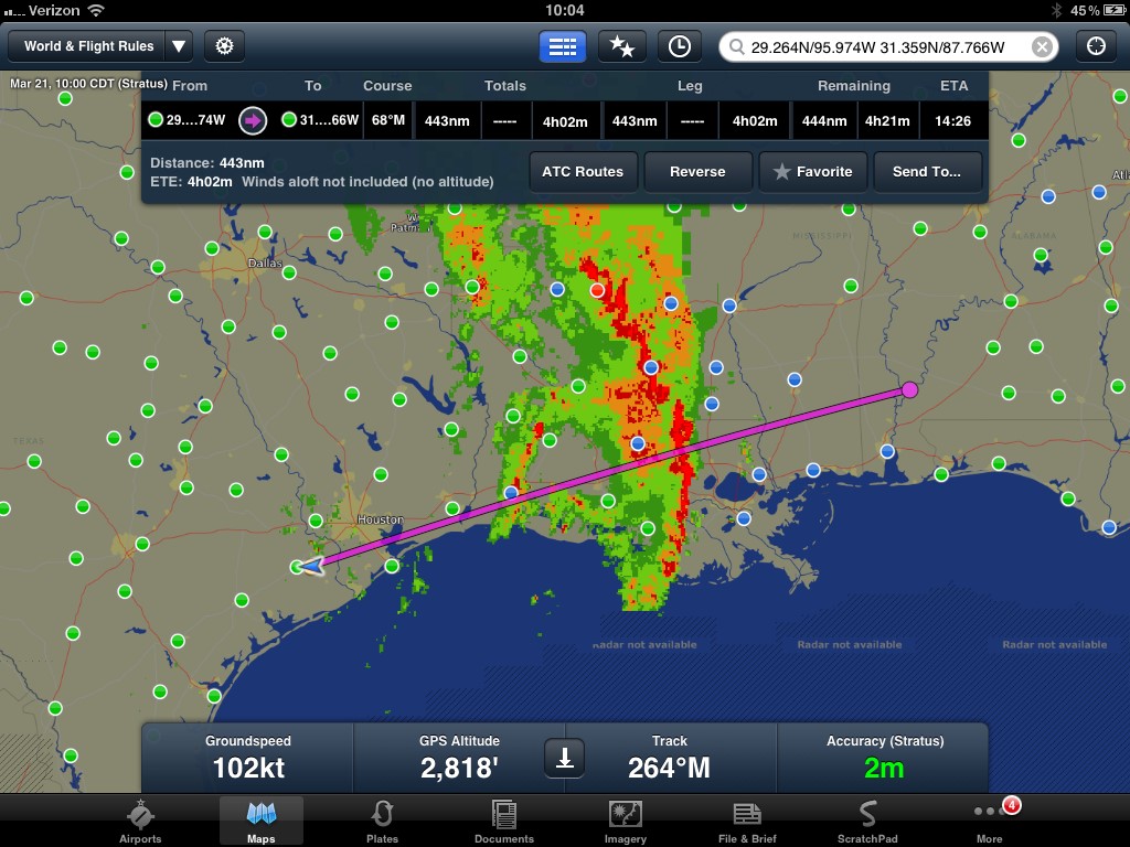
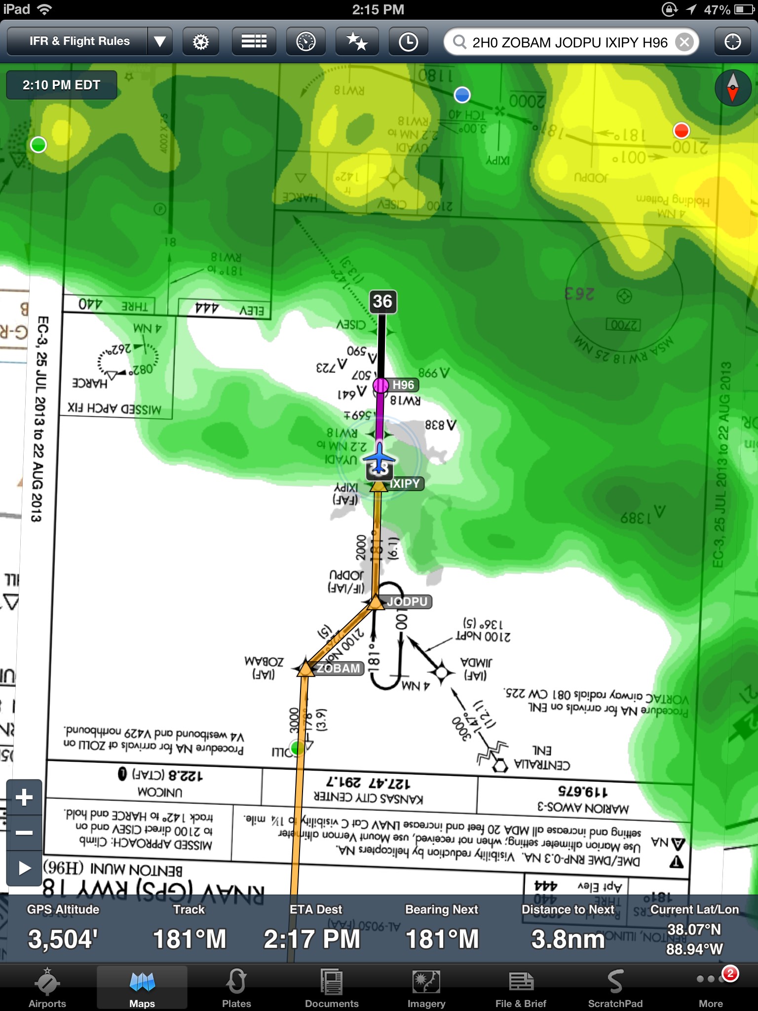
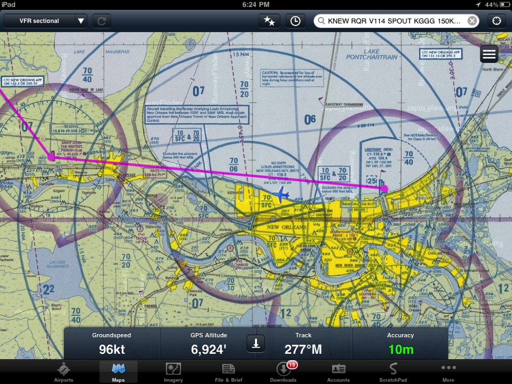
The app provides real time aerial maps and you don’t have to worry about magnetic tidal shifts compensations from time to time. The app updates them automatically. It provides flight rules, HD NEXRAD composite radar, visibility information, lightening, sky coverage, and wind conditions in maps.
Airport Facility Directory
It includes authentic/govt. provided information of all US airports along with all major airports of other countries. AOPA and Universal Weather and Aviation are also collaborating in providing data to ForeFlight. Availability of airports is also communicated in real time.
Weather
With moving maps, you have moving weather info available. The app provides info about weather throughout your journey with 10 weather slip maps. Temperature, humidity, wind conditions and dew point spread can be checked along the route of any particular flight.
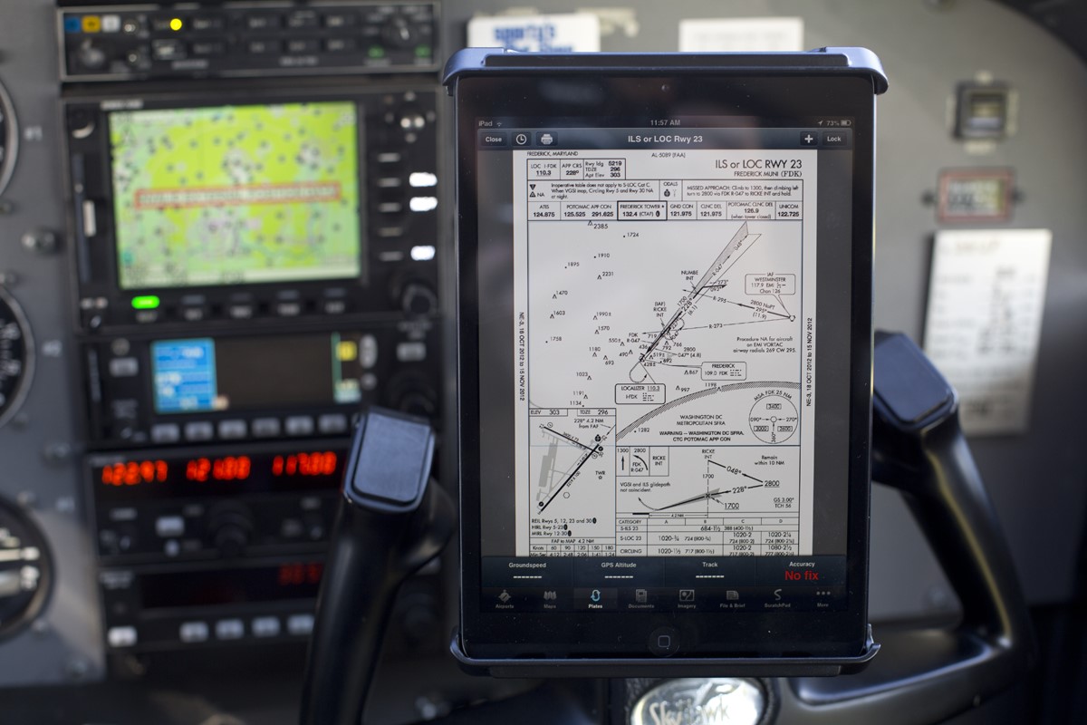
Charts
US VFR and Terminal Area Charts (TACs) can be accessed using this app. Gulf helicopter charts and US-Canadian route charts are also available and over 120,000 en-route charts are geo-referenced.
Final Word
The app seems to be pretty useful but not much has been found about it in press or electronic media. It is available for $74.99 with a Pro-version yearly subscription of $149.99. For VFR and IFR in Canada and geo-referencing you will have to pay an additional $149.99/year.
You can download it from here.